The Triangle’s Leading Edge
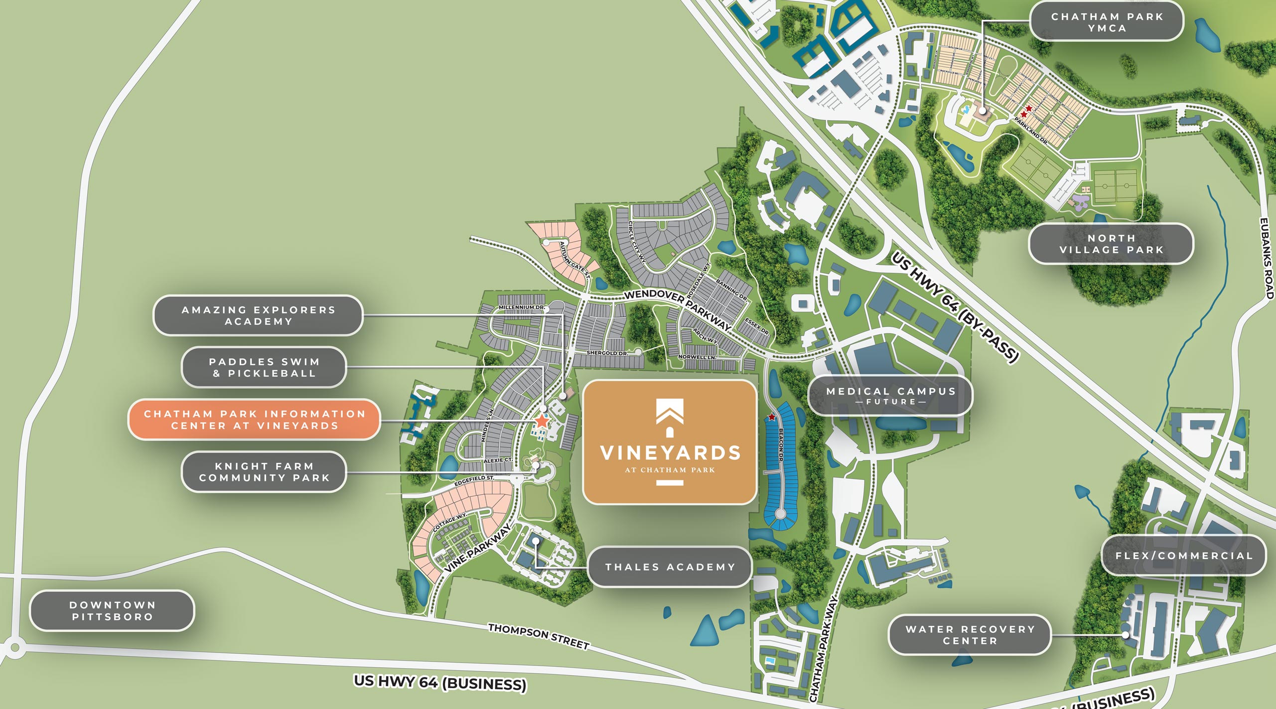
Located just west of Raleigh, Vineyards offers easy access to The Triangle, while still in walking distance to the charming historic streets of Pittsboro. It is the first residential neighborhood within the larger master-planned community of Chatham Park.


Chatham Park maps, renderings, and plans are illustrative and subject to change at any time to accommodate changes needed and desired for the development process. © 2025 Chatham Park. Last updated July 2025.
MAP LEGEND
VINEYARDS BUILDERS
Tri Pointe Homes & Townhomes
Garman Homes
Executive Homes: Upright Builders & Wagoner Homes

Model Home
Chatham Park maps, renderings, and plans are illustrative and subject to change at any time to accommodate changes needed and desired for the development process. © 2025 Chatham Park. Last updated July 2025.
MAP LEGEND
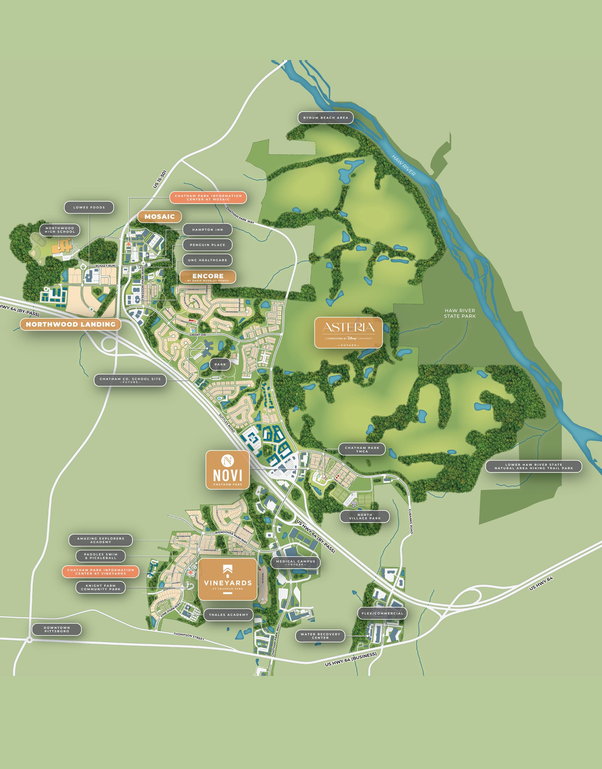
DEVELOPMENT DISTRICT PLAN
Chatham Park PDD Boundary
Mixed Use
Parks and Public Land
Open Space
Proposed Roadway
Pittsboro CTP Network Connections
MAP LEGEND
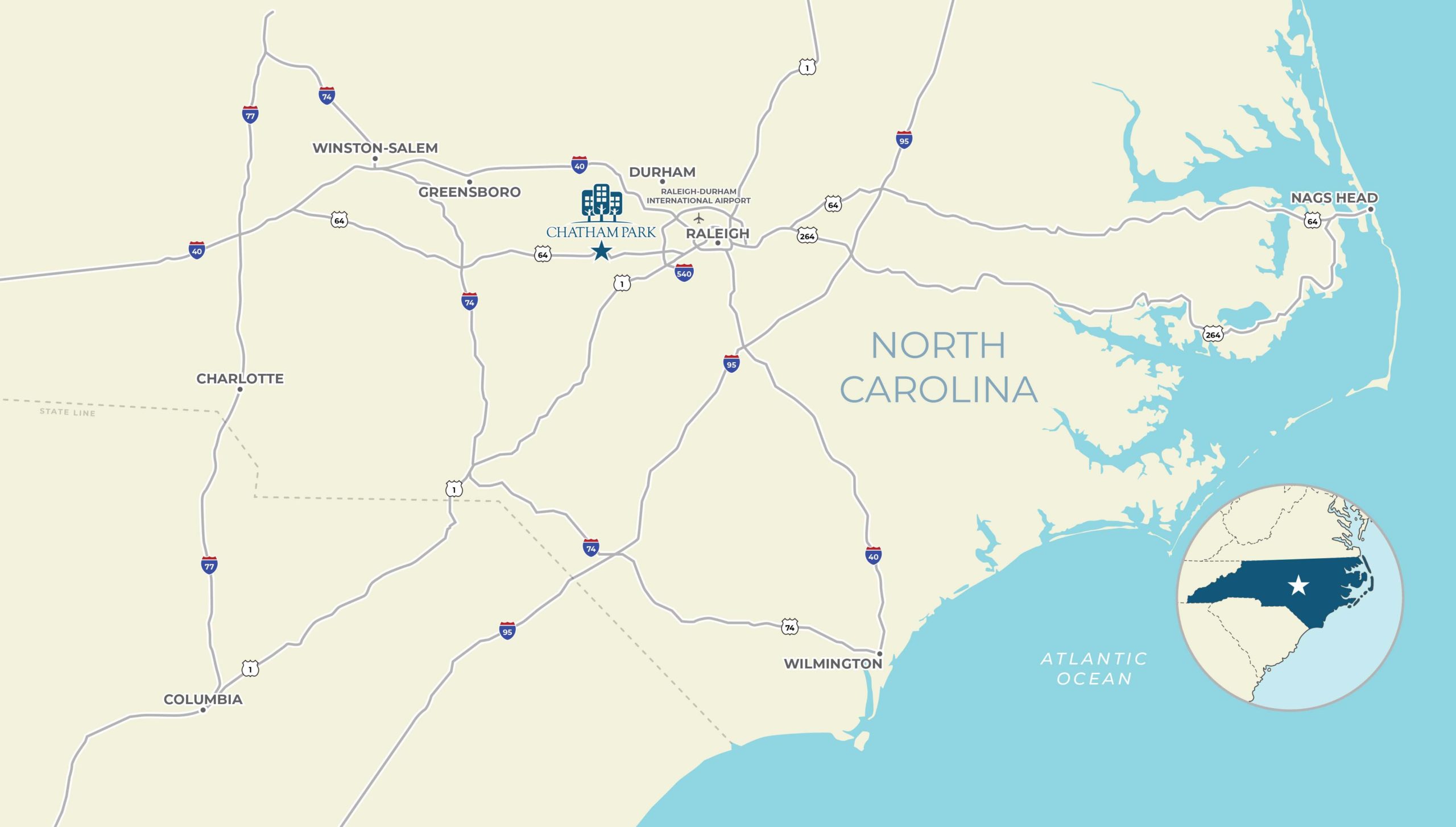
A STRATEGIC LOCATION
29 Miles to Raleigh-Durham International Airport (RDU)
30 Miles to Research Triangle Park
32 Miles to Raleigh
56 Miles to Greensboro
132 Miles to Charlotte
158 Miles to Wilmington
MAP LEGEND
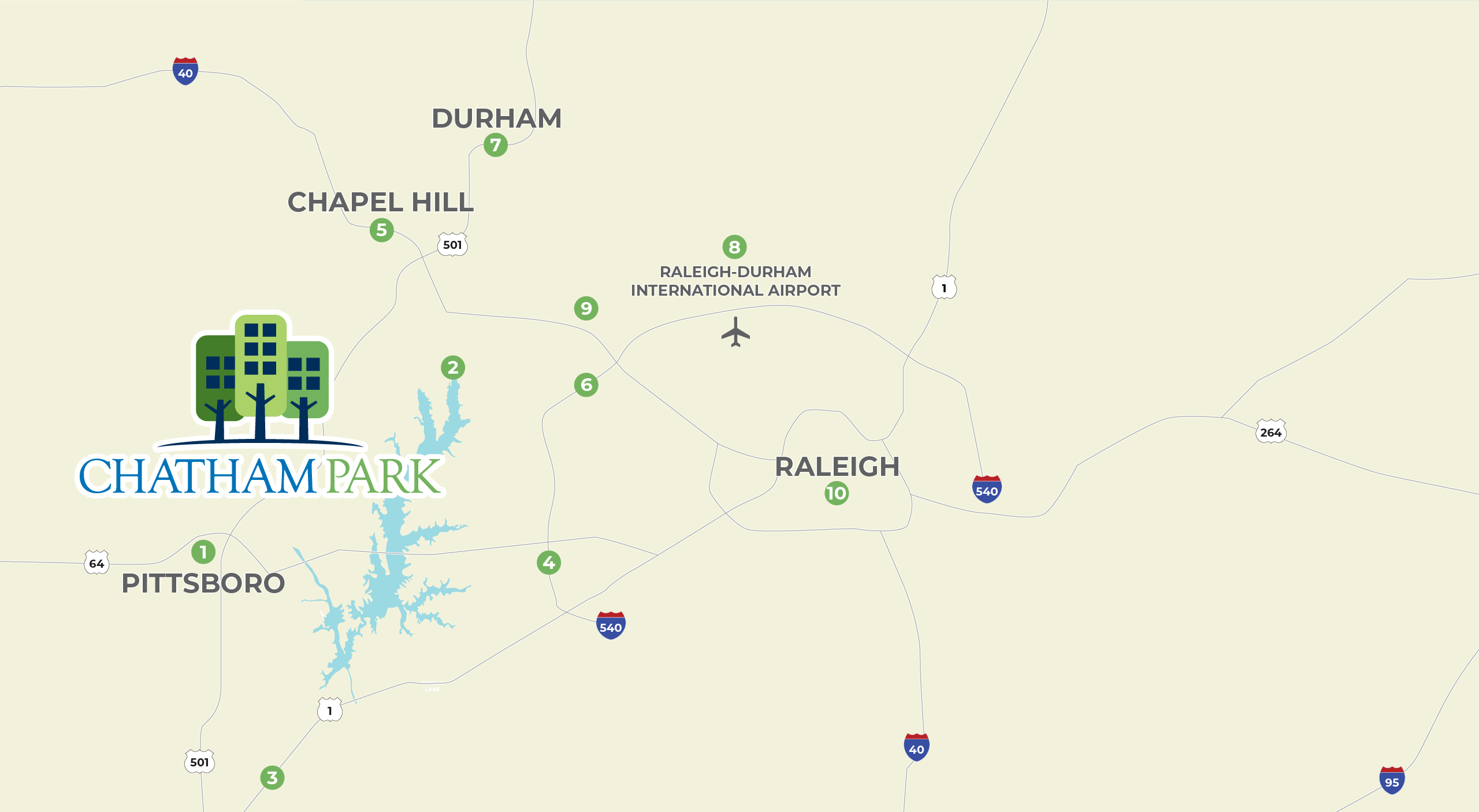
Everything within reach
Pittsboro (1 mile)
Jordan Lake (8 miles)
Raleigh Executive Jetport (15 miles)
Route 540 (15 miles)
Chapel Hill (18 miles)
Apple Campus Morrisville (24 miles)
Durham (29 miles)
Raleigh-Durham International Airport (29 miles)
Research Triangle Park (30 miles)
Raleigh (32 miles)